![](/images/other/stat-length.png)
![Excursión Senderismo Le Fau - GR 400 J5 réel 18 620m +854m - Photo](https://media.geolcdn.com/t/1900/400/ext.pjpeg?maxdim=2&url=https%3A%2F%2Fstatic1.geolcdn.com%2Fsiteimages%2Fupload%2Ffiles%2F1553511878bg_sport_marche.png)
GR 400 J5 réel 18 620m +854m
DanielROLLET
Usuario
![Longitud](/images/other/stat-length.png)
Longitud
18,6 km
![Altitud máxima](https://static1.geolcdn.com/siteimages/upload/files/1508320355ic_sort_altitude_max_24dp.png)
Altitud máxima
1548 m
![Desnivel positivo](https://static1.geolcdn.com/siteimages/upload/files/1508320355ic_sort_den_pos_24dp.png)
Desnivel positivo
854 m
![Km-Effort](/images/other/stat-length.png)
Km-Effort
30 km
![Altitud mínima](https://static1.geolcdn.com/siteimages/upload/files/1508320355ic_sort_altitude_min_24dp.png)
Altitud mínima
888 m
![Desnivel negativo](https://static1.geolcdn.com/siteimages/upload/files/1508320355ic_sort_den_neg_24dp.png)
Desnivel negativo
960 m
![Boucle](https://static1.geolcdn.com/siteimages/upload/files/16400158638029165_repeat_loop_refresh_sync_direction_icon.png)
Boucle
No
Fecha de creación :
2021-06-18 06:30:04.744
Última modificación :
2021-07-01 19:13:45.232
![Senderismo](https://static1.geolcdn.com/sitytour/trail-icons/101.png)
8h38
Dificultad : Muy difícil
![Escanee este código QR para abrir la excursión en la aplicación SityTrail](https://capi.geolives.com/qq0zvz2zws4bq2lad0pu/sitytour/trails/2831322/qr.png?size=200)
Aplicación GPS de excursión GRATIS
A propósito
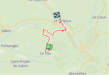
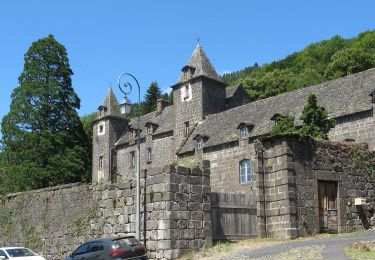
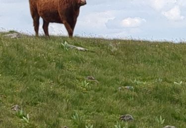
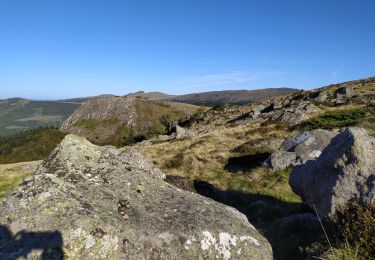
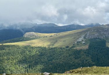
Ruta Senderismo de 18,6 km a descubrir en Auvergne-Rhône-Alpes, Cantal, Le Fau. Esta ruta ha sido propuesta por DanielROLLET.
Descripción
2021 06 18 08h20 à 17h00 Pause 12h30 à 13h00
Nombreux problèmes de marquage
Problème pour monter au Puy Violent
Problème au Violental, ne pas descendre sur la route avec cote 1179, tracé modifié.
Vitesse de progression assez faible.
Localización
País:
France
Región :
Auvergne-Rhône-Alpes
Departamento/provincia :
Cantal
Municipio :
Le Fau
Localidad:
Unknown
Salida:(Dec)
Salida:(UTM)
467222 ; 4994337 (31T) N.
Comentarios
Excursiones cerca
![Excursión Senderismo Saint-Projet-de-Salers - Col de Légal puy de Chavaroche - Photo](https://media.geolcdn.com/t/375/260/f9dc9d20-5b8f-465f-9704-8a80b10f246f.jpg&format=jpg&maxdim=2)
![Senderismo Senderismo](https://static1.geolcdn.com/sitytour/trail-icons/101.png)
Col de Légal puy de Chavaroche
Senderismo
Medio
Saint-Projet-de-Salers,
Auvergne-Rhône-Alpes,
Cantal,
France
![](/images/other/stat-length.png)
14,6 km | 25 km-effort
5h 33min
![](https://static1.geolcdn.com/siteimages/upload/files/16400158638029165_repeat_loop_refresh_sync_direction_icon.png)
Sí
![Excursión Bicicleta híbrida Mandailles-Saint-Julien - Tournemire - Photo](https://media.geolcdn.com/t/375/260/e14f03b2-11fc-4b1e-a416-809203cb4d66.jpg&format=jpg&maxdim=2)
![Bicicleta híbrida Bicicleta híbrida](https://static1.geolcdn.com/sitytour/trail-icons/203.png)
Tournemire
Bicicleta híbrida
Medio
Mandailles-Saint-Julien,
Auvergne-Rhône-Alpes,
Cantal,
France
![](/images/other/stat-length.png)
39 km | 50 km-effort
3h 2min
![](https://static1.geolcdn.com/siteimages/upload/files/16400158638029165_repeat_loop_refresh_sync_direction_icon.png)
No
![Excursión A pie Le Falgoux - Sentier de la cascade du Biaguin - Photo](https://media.geolcdn.com/t/375/260/9b956c23-a7e6-4fa5-9a0a-8ae63187caec.jpeg&format=jpg&maxdim=2)
![A pie A pie](https://static1.geolcdn.com/sitytour/trail-icons/100.png)
Sentier de la cascade du Biaguin
A pie
Fácil
Le Falgoux,
Auvergne-Rhône-Alpes,
Cantal,
France
![](/images/other/stat-length.png)
3,8 km | 5,5 km-effort
1h 14min
![](https://static1.geolcdn.com/siteimages/upload/files/16400158638029165_repeat_loop_refresh_sync_direction_icon.png)
Sí
![Excursión A pie Saint-Projet-de-Salers - Sur la route des transhumances étape 3 - Photo](https://media.geolcdn.com/t/375/260/141d518b-0ab0-4b07-be2a-c028168276ab.jpeg&format=jpg&maxdim=2)
![A pie A pie](https://static1.geolcdn.com/sitytour/trail-icons/100.png)
Sur la route des transhumances étape 3
A pie
Fácil
Saint-Projet-de-Salers,
Auvergne-Rhône-Alpes,
Cantal,
France
![](/images/other/stat-length.png)
12,4 km | 17,9 km-effort
4h 3min
![](https://static1.geolcdn.com/siteimages/upload/files/16400158638029165_repeat_loop_refresh_sync_direction_icon.png)
No
![Excursión Senderismo Saint-Paul-de-Salers - 11.08.2013 - Photo](https://media.geolcdn.com/t/375/260/ext.jpg?maxdim=2&url=https%3A%2F%2Fstatic1.geolcdn.com%2Fsiteimages%2Fupload%2Ffiles%2F1553511878bg_sport_marche.png)
![Senderismo Senderismo](https://static1.geolcdn.com/sitytour/trail-icons/101.png)
11.08.2013
Senderismo
Fácil
(1)
Saint-Paul-de-Salers,
Auvergne-Rhône-Alpes,
Cantal,
France
![](/images/other/stat-length.png)
10,6 km | 15,6 km-effort
3h 7min
![](https://static1.geolcdn.com/siteimages/upload/files/16400158638029165_repeat_loop_refresh_sync_direction_icon.png)
No
![Excursión Senderismo Le Falgoux - le falgoux - Photo](https://media.geolcdn.com/t/375/260/ext.jpg?maxdim=2&url=https%3A%2F%2Fstatic1.geolcdn.com%2Fsiteimages%2Fupload%2Ffiles%2F1553511878bg_sport_marche.png)
![Senderismo Senderismo](https://static1.geolcdn.com/sitytour/trail-icons/101.png)
le falgoux
Senderismo
Fácil
(1)
Le Falgoux,
Auvergne-Rhône-Alpes,
Cantal,
France
![](/images/other/stat-length.png)
7,8 km | 10,4 km-effort
2h 22min
![](https://static1.geolcdn.com/siteimages/upload/files/16400158638029165_repeat_loop_refresh_sync_direction_icon.png)
Sí
![Excursión Senderismo Saint-Paul-de-Salers - le puit violant - Photo](https://media.geolcdn.com/t/375/260/61384c01-5965-4bd4-865e-5985a8049078.jpg&format=jpg&maxdim=2)
![Senderismo Senderismo](https://static1.geolcdn.com/sitytour/trail-icons/101.png)
le puit violant
Senderismo
Medio
Saint-Paul-de-Salers,
Auvergne-Rhône-Alpes,
Cantal,
France
![](/images/other/stat-length.png)
4,2 km | 7 km-effort
22h 32min
![](https://static1.geolcdn.com/siteimages/upload/files/16400158638029165_repeat_loop_refresh_sync_direction_icon.png)
Sí
![Excursión Senderismo Le Fau - Puy violent - Photo](https://media.geolcdn.com/t/375/260/abb730dc-c4ed-4c8e-b196-15e705b50c2c.jpg&format=jpg&maxdim=2)
![Senderismo Senderismo](https://static1.geolcdn.com/sitytour/trail-icons/101.png)
Puy violent
Senderismo
Muy difícil
Le Fau,
Auvergne-Rhône-Alpes,
Cantal,
France
![](/images/other/stat-length.png)
22 km | 37 km-effort
8h 29min
![](https://static1.geolcdn.com/siteimages/upload/files/16400158638029165_repeat_loop_refresh_sync_direction_icon.png)
Sí
![Excursión Senderismo Saint-Projet-de-Salers - Col de Legal Cabrespine - Photo](https://media.geolcdn.com/t/375/260/7f51507d-5662-47ed-9e4c-8dfe19c46db4.jpg&format=jpg&maxdim=2)
![Senderismo Senderismo](https://static1.geolcdn.com/sitytour/trail-icons/101.png)
Col de Legal Cabrespine
Senderismo
Muy fácil
Saint-Projet-de-Salers,
Auvergne-Rhône-Alpes,
Cantal,
France
![](/images/other/stat-length.png)
8,2 km | 13,6 km-effort
2h 43min
![](https://static1.geolcdn.com/siteimages/upload/files/16400158638029165_repeat_loop_refresh_sync_direction_icon.png)
Sí